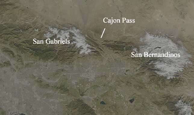
The drop, the canyon you pass through, is Cajon Pass. It is a critical transportation, infrastructure, and drainage corridor. It is also entirely a creation of the San Andreas Fault.
On your left side as you head towards L.A. are the San Bernardino Mountains. On your right, and more impressive in appearance, are the San Gabriels. They, and some other ranges to the west, constitute the Transverse Ranges, a east-west set of ranges. They are really one mountain range, formed from the compression along a kink in the San Andreas slip-strike fault. The motion of the Pacific plate, normally slipping smoothly, rides hard against the North American Plate at this location, compressing the land up into an unstable, steep, untenable range.
Why there is a usuable (although steep) pass right in the middle of the mountains can't be ascribed to luck--the San Andreas Fault runs NW-SE right through the pass. You can see a diagram of this from here: http://www.laep.org/target/fragile_habitats/images/mtns_calif.gif (The link was down today but it's been up before).
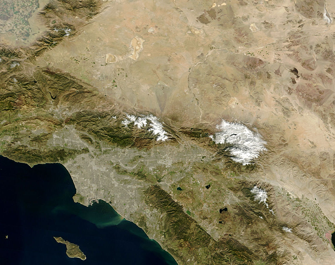
Also, I've annotated a TERRA image of Southern California:
The full image showing the whole region is here:

This is a nice block diagram showing the region from the USGS.
Imagine sliding the left side of the satellite image down and to the right, and now the San Gabriels and San Bernandinos line up.
Not only does the fault create the range, it also slices the range up.
University of Chicago and Hyde Park types will be amused by the roads in the small settlement near the base of the canyon. Google Hybrid link.
Another point of interest is the strongest plume of sediment you can see in the ocean. The Cajon Pass drains through a convoluted path of washes, creeks, and dams to the sea right there. Is some of that silt from the rapidly eroding rocks of the Pass? Absolutely.
I originally started writing this entry in August, trying to start out with a broad comment about how geology completely controls topography. I am amazed at how every geographic and topographic structure can be explained geologically. That approach to the entry didn't work, so instead I wrote about a specific instance. And what's amazing is I am finding these explanations everywhere.
1 comment:
Thanks Mary!
Post a Comment